“Zaragoza Histórica” is a new tool that allows citizens the discovery of the historical evolution of the city through its cartography.
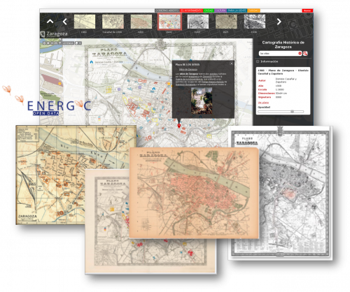
This new service disposes of an interactive viewer that makes possible to overlay a selection of the historic maps catalogue of Zaragoza on the actual cartography and compare the evolution of the city.
So far, there has been published a collection composed by 20 maps of XVIII, XIX, XX y XXI centuries that will be enriched in the future.
A careful work of digitalization and georeferencing of maps, together with the availability of a mature map visualization technology, have made possible the development of this interesting tool for analysing the evolution of the city.
“Zaragoza Histórica” is a new service of the Spatial Data Infrastructure of Zaragoza (IDEZar) whose objective is to offer citizens urban information in a simple and intuitive way by means of maps.
This work is the result of the collaboration between the Office of Participation, Transparency and Open Government of the City Council of Zaragoza and the Municipal Archive with the Universidad de Zaragoza (Advanced Information Systems group, IAAA), in the frame of the ENERGIC OD project, an innovation project financed by the European Commission FP7. The object of this project is to generate a framework to allow homogenous distribution of open geographic information, being City Council of Zaragoza a case of use.